
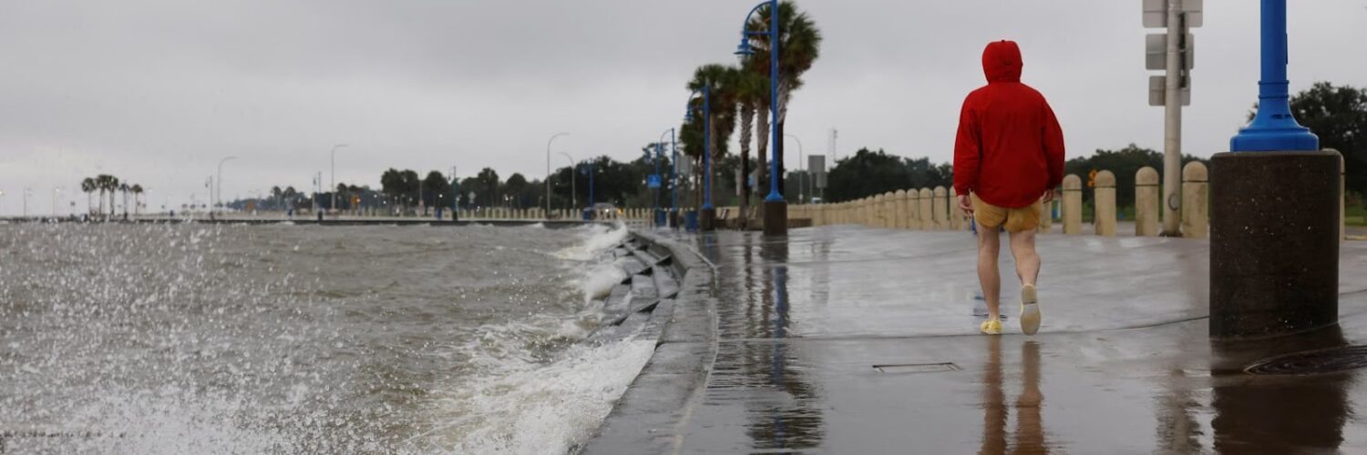
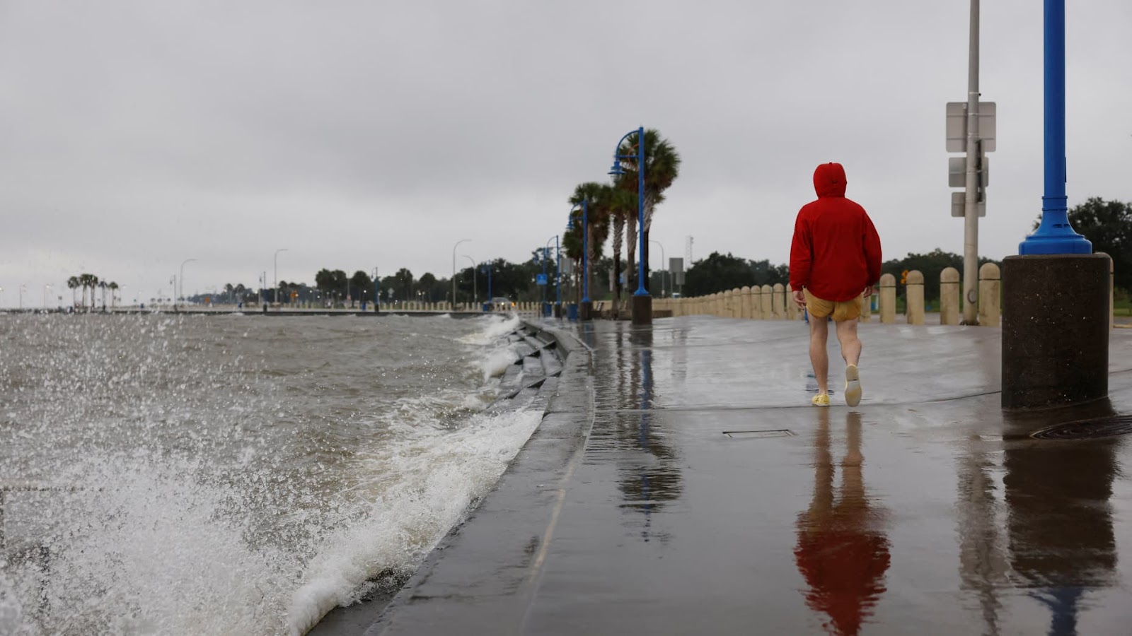
Waves from Lake Pontchartrain crash against the seawall along Lakeshore Drive as Hurricane Francine was intensifying before its expected landfall on the U.S. Gulf Coast, in New Orleans, Louisiana, U.S. Sept. 11, 2024. (Courtesy/ Edmund Fountain – Reuter)
As the nation began to cool down from the hottest summer in recorded history, residents of southern states prepared for the coming of hurricane Francine, the sixth named storm of the Atlantic hurricane season.
Originally dubbed Potential Cyclone Six on Sept. 8, hurricane Francine intensified into a tropical storm as it traveled along the Gulf of Mexico. By the time it had reached landfall near Morgan City, Louisiana, the storm had grown into a category two hurricane, with sustained winds reaching up to 100 mph.
After reaching landfall on Wednesday, Sept. 11, the hurricane weakened to a tropical storm and later to a depression – a weaker type of tropical cyclone with a maximum sustained wind speed of 38 mph or less. Hundreds of thousands of residents across southern Louisiana, Mississippi, and Alabama were met with flash floods, property damage and widespread power outages.
“My friend said he had fish in the streets in Kenner near where he lived,” said Myles Mackie, a student at Howard University and Louisiana Native.
Shay O’Connor, a reporter for New Orleans local news station WDSU 6, documented dozens of fish scattered about the flooded streets of Kenner, Louisiana.
“My guess is they came from the canal nearby,” said O’Connor. “If the water does recede, it cannot be good for the fish.”
However, the displacement of fish is only a minor concern compared to the threat that future hurricanes pose.
According to data collected by the National Oceanic and Atmospheric Association (NOAA), hurricane Francine arrived at the peak of the Atlantic hurricane season. With global temperatures rising each year due to climate change, scientists warn that intense hurricanes await us.
As global temperatures continue to rise, so do sea surface temperatures. In 2024 NOAA recorded daily sea surface temperatures at unprecedentedly high temperatures. These elevated sea temperatures are a crucial factor in the formation of hurricanes.
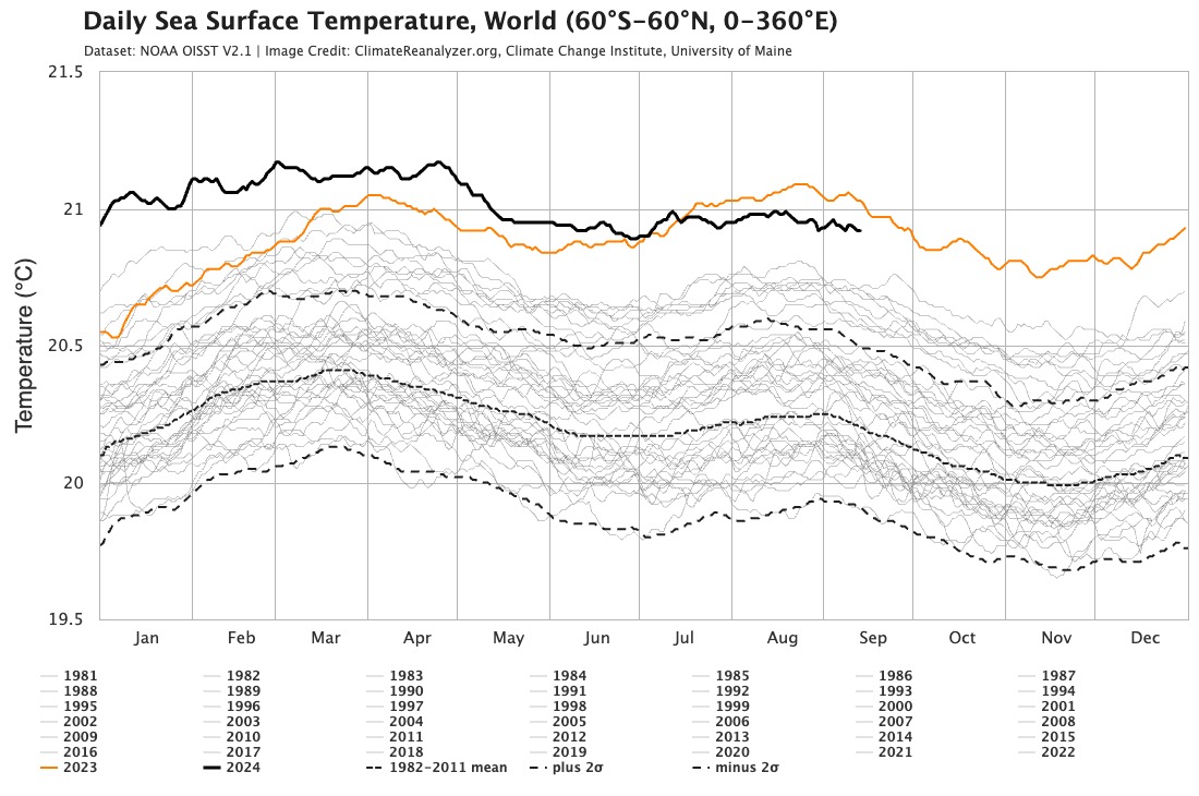
For a tropical storm to develop into a hurricane, sea surface temperatures must exceed 26 degrees Celsius (79 degrees Fahrenheit). The formation of Hurricane Francine caused the Gulf of Mexico to surpass this threshold; reaching a warm 31 degrees Celsius (87 degrees Fahrenheit). (Courtesy/climatereanalyzer.org)
Raised sea surface temperatures also caused an increase of water vapor in the air due to evaporation. As storms travel, they collect this water vapor from the air, bringing heavier rainfall and more frequent flooding to land.
The combination of stronger storms and rising sea levels will make flash floods and storm surges more common. Over the past decade, flash floods have become the leading cause of tropical cyclone-related deaths, a sign that the nature of hurricanes is evolving. This reality underscores the need for scientists and governments to develop strategies to mitigate these growing challenges caused by climate change.


Recent Comments